USGS - science for a changing world

Open-File Report 03-007

Bathymetry and Acoustic Backscatter of the Mid and Outer Continental Shelf, Head of De Soto Canyon, Northeastern Gulf of Mexico—Data, Images, and GIS

Images

HOME
INTRODUCTION
IMAGES
DATA
METADATA
ARCEXPLORER
CRUISE REPORT

Click on a regional button to view that region's shaded-relief bathymetry and acoustic backscatter imagery
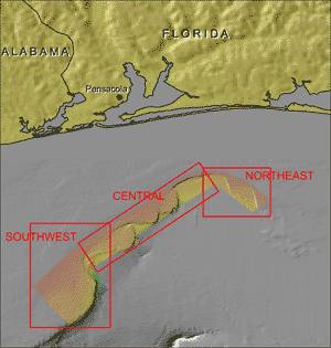
Southwestern region of the Mid and Outer Continental Shelf, Head of De Soto Canyon, Northeastern Gulf of Mexico Central region of the Mid and Outer Continental Shelf, Head of De Soto Canyon, Northeastern Gulf of Mexico Northeastern region of the Mid and Outer Continental Shelf, Head of De Soto Canyon, Northeastern Gulf of Mexico
Location map of the Mid and Outer Continental Shelf, Head of De Soto Canyon, Northeastern Gulf of Mexico


Accessibility FOIA Privacy Policies and Notices

Take Pride in America logo USA.gov logo U.S. Department of the Interior | U.S. Geological Survey
URL: http://pubsdata.usgs.gov/pubs/of/2003/0007/images.html
Page Contact Information: GS Pubs Web Contact
Page Last Modified: Tuesday, 01-Apr-2014 13:27:05 EDT